Second landfall expected over weekend in NT as Queensland premier says relatively limited damage so far ‘an incredibly good news story’
Live updates: Severe Tropical Cyclone Narelle – latest news
Cyclone Narelle path tracking map
How did global heating fuel Tropical Cyclone Narelle?
Get our breaking news email , free app or daily news podcast
Severe Tropical Cyclone Narelle barrelled across far north Queensland on Friday as one of the state’s fiercest cyclones in living memory – downing trees, ripping off roofs and swelling rivers.
The system crossed the Cape York peninsular at 7am on Friday as a “high-end” category 4 storm with sustained winds of 195km/h – just 5 km/h short of being a category 5 storm.
On Friday afternoon, Queensland premier David Crisafulli said Narelle had moved west, crossing on the east coast between Lockhart River and Coen.
“It threaded a needle between both.
While there’s some damage we’ve seen, and some rain and some wind, that’s an incredibly good news story”, he said.
The system is expected to cross the western part of the Cape later on this evening, and for communities in those areas – particularly Aurukun and Weipa, the intensity will continue to pick up, as well as rainfall.
“It will be some time before we find out how widespread the destruction is,” Crisafulli said.
Climate experts have said global heating helped to super-charge Narelle, with high ocean temperatures helping the storm gain intensity as it approached the coast.
Communities in the Northern Territory, which has been hit by consecutive flooding events in recent months, were making final preparations for Narelle’s arrival this weekend.
The storm was forecast on Friday afternoon to continue west, skirting the Cape York town of Aurukun, before re-intensifying over the waters of the Gulf of Carpentaria.
A second landfall was expected late on Saturday night or early Sunday near the island of Anindilyakwa on the Top End’s east coast.
The storm is then forecast to keep tracking west over already-saturated areas around Katherine, south of Darwin, on Sunday.
On Friday afternoon, Narelle weakened to a still-severe category 3 system with destructive wind gusts up to 185 km/h.
Authorities said there were currently 11 warnings still in place from Cape York to Cape Melville, but there had been no rescues by mid-afternoon Friday.
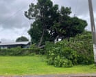
Debbie Jackson, who lives on a property 50 km north of Coen, said they were “losing roofs everywhere” as the system made landfall.
“Lots of trees down.
We have lost a few roofs.
It’s not real great,” she said, adding she was with seven people sheltering in a shipping container until the storm had passed.
The system had been tracking towards the town of Coen, with a population of about 320, in the early hours of Friday but took a slight northward shift as it made landfall.
Authorities warned of combined threats from strong winds, heavy rain, flooding from already-swollen river systems and storm surge in coastal areas, as the cyclone arrived close to a high tide.
Coen locals said the town had been eerily calm on Thursday, but that heavy winds began to pick up about 4am.
“You can hear a couple of things moving around outside now,” said Sara Watkins, owner of the local mechanic and bush pantry.
“Until the wind started it was so still.
It was raining but it was really still.
That’s not like Coen, when it rains it pours and the wind moves about.”
The Bureau of Meteorology said Narelle was likely to weaken to a category 1 cyclone as it travelled across the heart of the Top End through Sunday, where between 100mm and 200mm would likely cause renewed major flooding in areas including Katherine and Daly River.
Climate experts said Narelle was likely fuelled by climate change , with the system moving west over the Coral Sea where sea surface temperatures have been at record highs in recent months.
Higher ocean temperatures provide more fuel for cyclones, increasing their intensity.
Coastal inundation will be worsened by rising sea levels and the system will also be able to produce more rainfall, also due to global heating, scientists say.
Emergency warnings have been issued for the Lockhart River, Port Stewart and Coen.
Related Stories


Source: This article was originally published by The Guardian
Read Full Original Article →
Comments (0)
No comments yet. Be the first to comment!
Leave a Comment